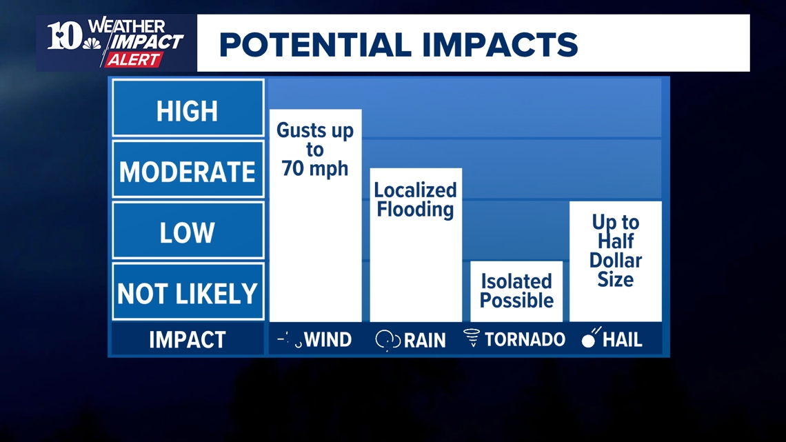
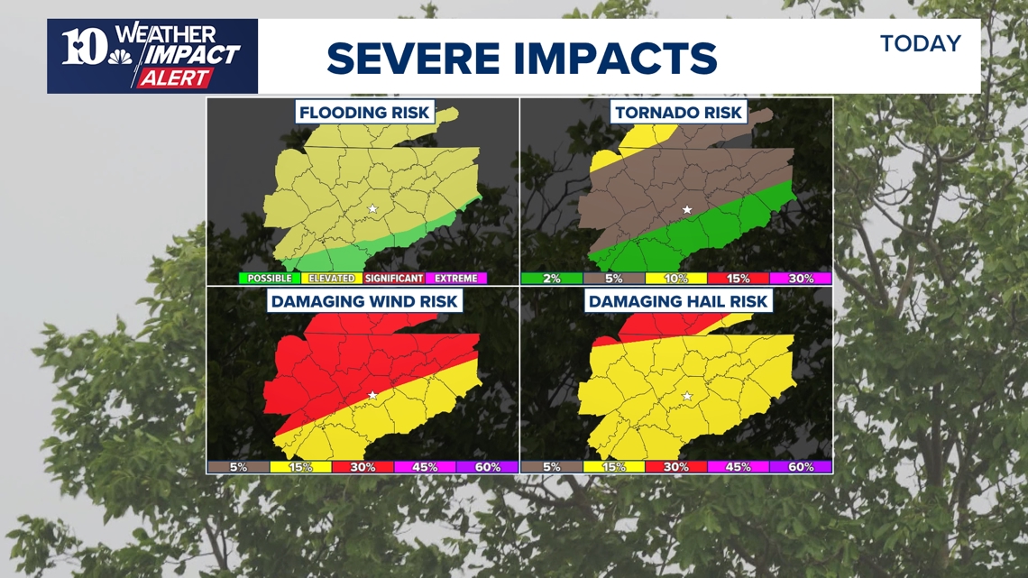
The primary threats are damaging winds of at least 70 mph and hail. There is also a risk of isolated tornadoes, mainly for areas along and north of I-40.
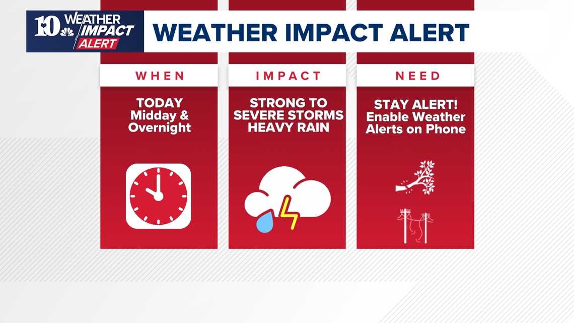
KNOXVILLE, Tenn. — Two rounds of storms will be possible today. The first round of storms will be likely across the Tennessee and Kentucky line. Although there is less confidence with these storms developing, if they do, strong supercells with all modes of severe weather are possible.
There is also a possibility for severe storms to pass through East Tennessee late tonight, lasting until Saturday morning and bringing damaging winds of at least 70 mph and hail. There is also a risk for isolated tornadoes, mainly for areas along and north of I-40.
THREATS
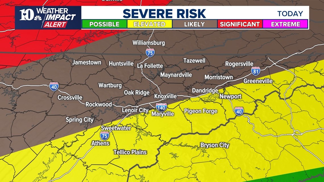
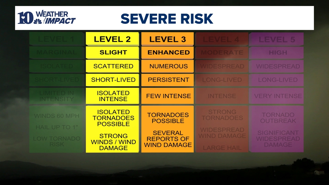
Different parts of East Tennessee range from a Level 2 to a Level 3 (out of 5) risk of severe storms as a cold front advances from the west. The result could be winds of at least 70 mph, which could topple trees, as well as hail of up to 1.5 inches in diameter, which is the size of ping pong balls.
There is also a risk for isolated tornadoes for areas along and north of I-40. This threat will be arriving after dark and lasting into the overnight hours, so people are encouraged to have a way to receive weather alerts and notifications that can wake them up if they plan to head to bed before the storms arrive.
Heavy rain between 1 inch and 3 inches could also lead to localized flooding. As the ground becomes more saturated and with most trees now full of leaves, the risk of trees falling could grow. Wind could also knock down power lines.

TIMING
A few strong to severe storms will be possible this afternoon around noon into the early part of the afternoon. As for tonight, severe weather is anticipated to begin by around 10 p.m. and last through 4 a.m. Saturday. However, that timing could still change to earlier or later, so please check back for updates as WBIR continues to refine the details.


IMPACTS
When thunder roars, head indoors! Strong winds could make it dangerous to be outside, and so people should make sure to stay somewhere safe while the storms move through. They should also have a way to stay updated on weather alerts, in case the power goes out.
With the possibility of tornadoes in some areas of East Tennessee, people should also have a plan on how to get to a safe place in their homes. They should identify a place without any windows and with as many walls as possible between them and the outside — usually a basement or a bathroom — to shelter in if a tornado warning is issued for their area.
They should also have a bag packed with essentials in case the power goes out or there is damage to their homes. Bags should include any necessary medication, power banks for cell phones, important documents and other kinds of essentials.