- Sunny and dry through Tuesday
- Strong cold front moves through Wednesday
- Dropping temperatures by the end of the week
MADISON, Wis. (WMTV) – Sunday evening is shaping up to be a calm and comfortable one in southern Wisconsin, with clear skies and light winds.. The main thing to watch overnight will be fog. Conditions are favorable once again for patchy fog to develop, especially west of Madison and in the low-lying valleys near the Kettle Moraine. If you’re on the roads late tonight or early Monday morning, be ready for a few spots of reduced visibility. Any fog that does form will fade quickly once the sun is up.
Labor Day Monday looks really nice. After any early morning fog burns away, skies will be mostly sunny through the afternoon. Temperatures will climb into the mid to upper 70s. Winds stay light, making for a quiet finish to the holiday weekend. Monday night could see another round of patchy fog in the usual spots, but otherwise, conditions stay clear and dry.
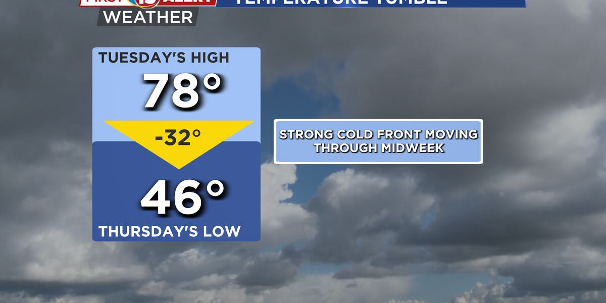
Tuesday brings more of the same, though temperatures will run a bit warmer, with highs pushing toward 80 degrees in many spots. With high pressure still in control, skies stay mostly sunny and dry through the day. It will be the warmest day of the week, and also the last of the calm stretch before changes arrive midweek.
What’s Coming Up…
By Tuesday night into Wednesday, focus turns to a strong cold front dropping out of the northwest. This will be our next significant weather maker, and there is a good chance of showers and thunderstorms as it moves through the region. The timing of the front is still a little uncertain, but confidence is high that Wednesday will be an active weather day. While rainfall amounts don’t look especially heavy, the system will have enough energy to produce a round of thunderstorms as it passes.
Once the front moves through, the bigger story will be the change in temperatures. Much cooler air arrives behind the boundary, with highs on Thursday and Friday likely only in the 50s and low 60s. Morning lows could dip into the 40s, and in the cooler valleys, even the upper 30s can’t be ruled out. It will feel more like mid-October than early September.


Looking Ahead…
By the weekend, temperatures should slowly start to rebound, climbing back closer to 70 by Saturday and Sunday. But before then, we’ll go from a warm and quiet start to the week, straight into a stormy and much cooler midweek pattern.

Click here to download the WMTV15 News app or our WMTV15 First Alert weather app.
Copyright 2022 WMTV. All rights reserved.