ROCHESTER, Minn. (KTTC) –It has certainly been a nice summer day in southern Minnesota and northeast Iowa! Many of us have experienced a mix of clouds and sunshine, accompanied by slightly breezy conditions. High temperatures today have topped off in the 70s and 80s across southern Minnesota and northeast Iowa. It’s also been humid with dewpoints reaching in the upper 60s and low 70s- allowing us to feel tropical-like.
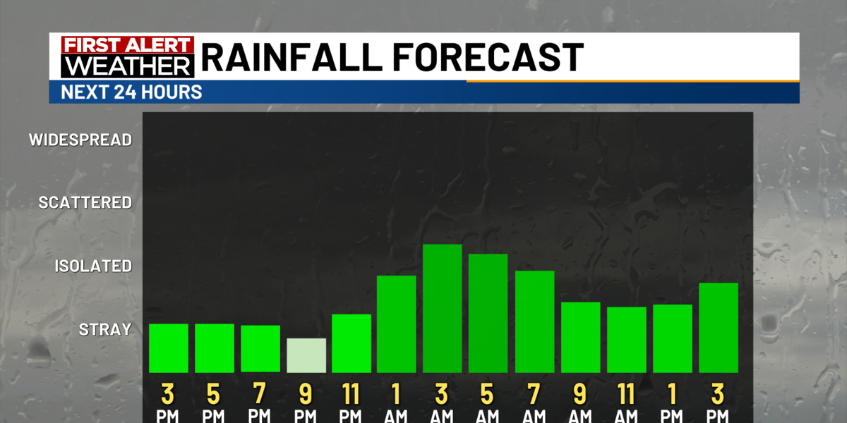
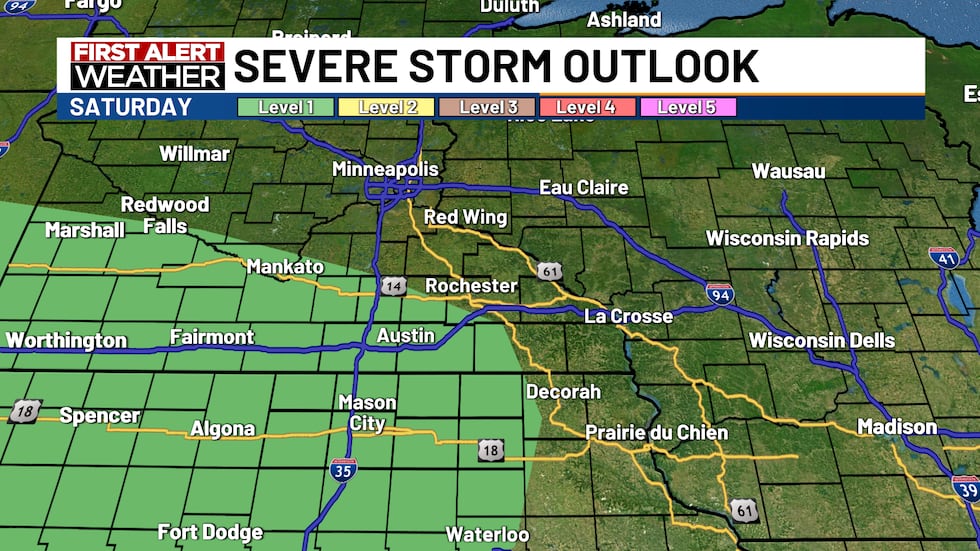
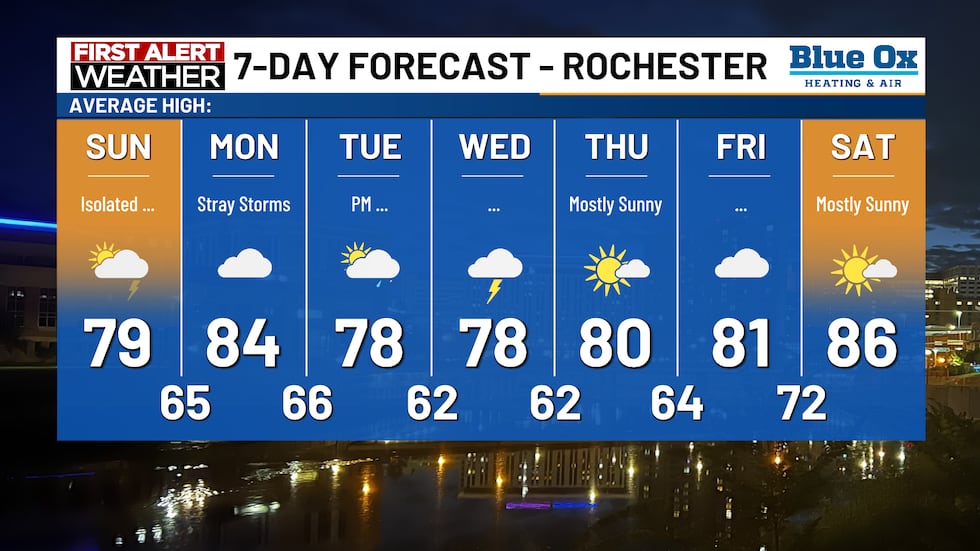
With the heat and humidity around, stray storms bubbled up in northeast Iowa earlier this afternoon. This evening and tonight, shower and storm chances return to the forecast. Some of these showers and storms may linger through the mid-morning hours on Father’s Day. The Storm Prediction Center (SPC) has our viewing area in a Level 1 Risk for strong storms. If storms do turn strong, hail and wind would be the primary concern. Overnight, though heavy rainfall is also a possibility in thunderstorms.
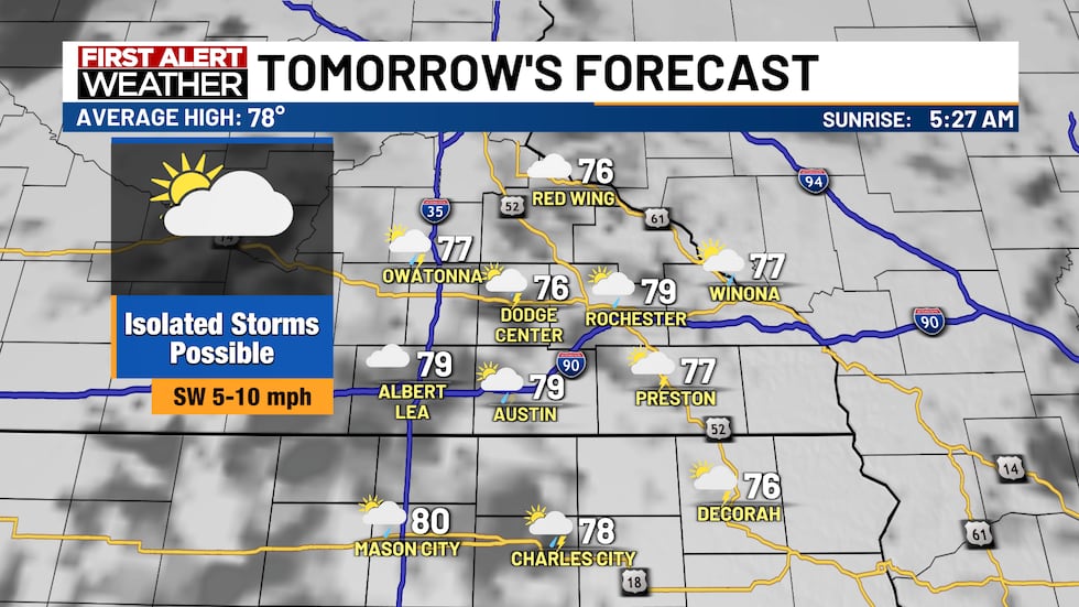
Throughout the afternoon and evening on Father’s Day, isolated showers and storms are expected to roll through portions of southern Minnesota and northeast Iowa. Otherwise, mostly cloudy skies are expected, along with highs reaching the 70s and 80s once again- dewpoints will be in the 60s.
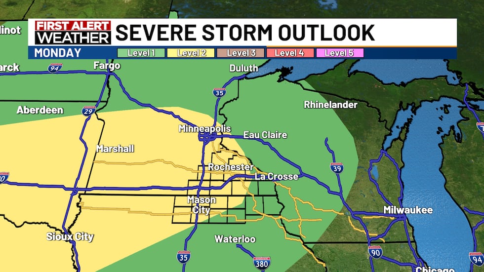
Shower and storm chances continue through this week. We will keep a close eye on Monday as the SPC has our viewing area in a level 1 and 2 risk for severe weather. Keep that umbrella close by throughout this week!
I hope all the dads and father figures have a great Father’s Day Weekend!
Find stories like this and more, in our apps.
Copyright 2025 KTTC. All rights reserved.